
Mapping in Västernorrland
The mapping of innovation-critical minerals and metals in the Västernorrland county is a part of SGU's long-term plan for the period 2021–2027. It includes systematic mapping of energy, battery, and innovation-critical metals and mineral.
The main goal is to update the geological, geophysical, and geochemical data of the bedrock within this area and to provide new knowledge and information related to understanding the mineral systems and the genesis of mineral deposits, including lithium, tin, tungsten, niobium and tantalum.
The project started in May 2021 and will be completed in 2027. Collected geological, lithogeochemical, and geophysical data are continuously made available in the SGU's databases. The results will also be summarized in a SGU report with a new synthesis of the bedrocks, structures and ages of rocks as well as geophysical and geochemical interpretation in Västernorrland.
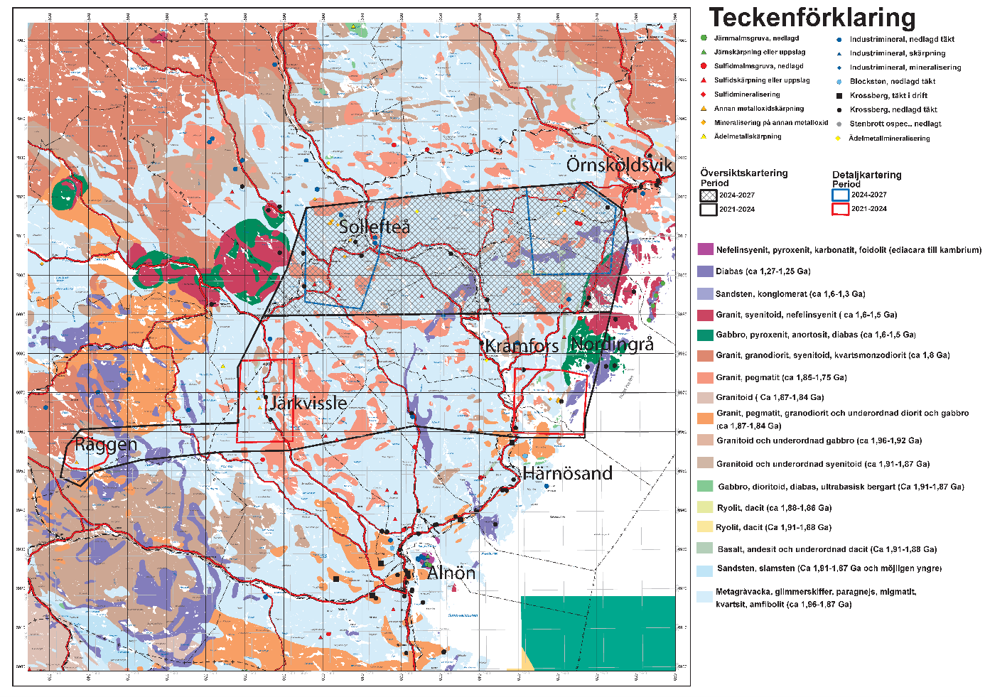
In addition to the regional bedrock mapping in Västernorrland, detailed mapping is carried out to update geological information and mineralisations within five selected areas, based on the potential for mineralisations of lithium, niobium, tantalum, gold, copper, and cobalt.
The mapping period for the Kramfors, Järkvissle, and Räggen areas was 2021–2023. Mapping in the Orrvik area it is currently ongoing from 2024–2025, and the Sollefteå area is planned for the years 2025–2027. An interim report from the project was published in 2022.
Bedrock geological investigation of critical metals and minerals, Västernorrland (report in Swedish)
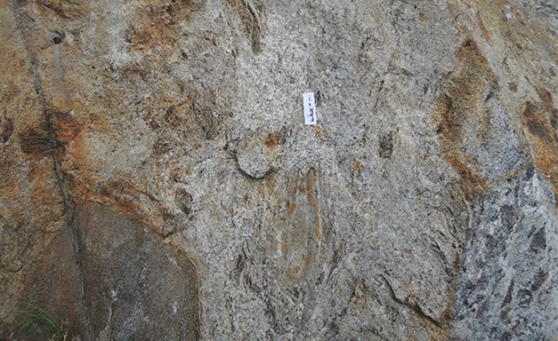
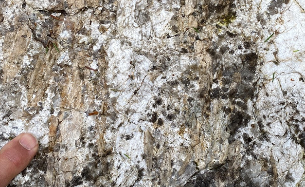
Example of commonly occurring diatexitic migmatite in the mapping area.
Photo: Martiya Sadeghi/SGU
Thousands of new measurements and samples
Since the mapping began in 2021, SGU has carried out approximately 2000 outcrop observations and collected hundreds of samples for various analyses. Among these, we have collected 493 samples for analysis of rock chemical composition (Lithogeochemcial analysis). Additionally, 15 samples have been taken for age determination of rocks, with the results of the age determinations to be published in 2025.
SGU has also conducted geophysical surveying and sampling to collect a large amount of geophysical basic data. Through airborne geophysical surveys over an area of approximately 5000 square kilometers, the authority has collected information on the Earth's magnetic field strength, the electrical conductivity of the ground, and gamma radiation, which shows the levels of potassium, uranium, and thorium in the ground.
So far, a total of 573 new rock samples have been taken for petrophysical analysis, 468 ground measurements of gamma radiation have been conducted, and gravity measurements have been made at 2970 locations. This can be compared to the 235 petrophysical analyses, 65 gamma radiation measurements, and 1695 gravity measurements that existed within the entire project area before 2021.
New results from abandoned mines
An example of a site investigated in Västernorrland is the abandoned mine called Bolagsgruvan, or Förnätra mine. New lithogeochemical sample results from waste rock show high values of copper, silver, selenium, and anomalous values of nickel, rhenium, as well as elevated levels of cobalt and palladium. Pyrrhotite, pyrite, and chalcopyrite are the most dominant ore minerals along with previously known pentlandite. The copper content of the samples ranges from 0.4–1 percent for the two sampling points at Nätraberget.
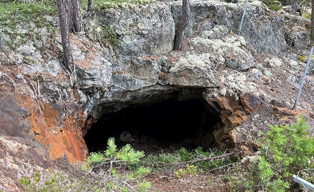
The Eastern Mine Shaft at Bolagsgruvan
Photo: Hugo Hedin Baastrup/SGU
Valuable for SGU and others
Through the project, SGU receives a large and important addition of new, modern baseline data. In the key area at Järkvissle, the regional airborne geophysical data and gravity data have been used together with older slingram data (which can also be used to calculate the electrical conductivity of the ground) for method development in geophysical 3D modeling. Regional geological, geophysical, and geochemical data from the project area are also used in the development of a tool for predictive mapping (machine learning), which is being developed in parallel within the EU project EIS, in which SGU is involved.
Spodumene-bearing (lithium aluminum silicate) Pegmatite from the Järkvissle Area
Photo Martiya Sadeghi/SGU
Last reviewed 2025-02-28